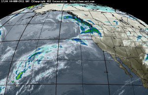
Looking at the models over the past few days they continue to bring in less precip for the warm part of the storm this weekend. There is a long subtropical tap stretching all the way back to Hawaii that will be pushed into Northern CA by the low spinning in the Gulf of Alaska tonight. By the time the moisture is pushed into Tahoe Saturday afternoon the subtropical tap of warm moisture will be cut-off from the storm. We will see light amounts of snow on the mountain Saturday night through Sunday night above the base. Right now it looks like about 4-8 inches of snow from mid-mtn up during this first part of the storm.
Then Sunday night the cold front approaches and pushes through Tahoe by Monday morning. This will drop snow levels below the base and bring a heavy burst of snow alont with it, with snow showers behind it for most of the day on Monday. Currently it looks as if we could see around 4-8 inches at the base and an additional 8-12 inches on top. This will be some colder snow on top of the wetter stuff from the weekend very similar to what we just had with the last storm. Storm totals by the Tuesday morning snow report should be close to this last storm as well in the 10-20 inch range.
Starting Tuesday there is a ridge off the coast blocking storms and bringing nice weather for a few days. Then that ridge pushes East as another ridge sets up around 140w in the Central Pacific by the end of next week. This will open back up the storm door to some colder storms coming down the East side of the ridge. The location of the ridge at 140w would mean we will get a series of cold but smaller storms.
There are going to be quite a few storms coming across the Pacific from next weekend and beyond so the pattern of a storm every other or every couple of days looks to continue from the 11th through the 20th. Around the 16th the ridge may retrograde further west towards 150-160w allowing the storms to dig and pick up more moisture. The best chance at another big storm looks to be if/when this happens, possibly around the 19th. Now that we are in March with a stronger sun it should be nice between each storm and then a shot of cold and snow with each. BA

Comments