The first in a series of potent storms is moving eastward, slated to impact utah for the next few days. Although most of the energy will be south of the wasatch, the good news is that an active storm track in now present. Hopefully this is the start of something good. And when I say good I mean 20 feet of snow.here is what the National Weather Service has to say:"THE LEADING EDGE OF THE NEXT STORM SYSTEM WILL ENTER THE REGION LATE TONIGHT...AND LAST INTO TUESDAY AFTERNOON. THE POTENTIAL FOR SIGNIFICANT SNOW EXISTS...ESPECIALLY OVER CENTRAL AND SOUTHERNUTAH WHERE UP TO 4 FEET OF SNOWFALL IN THE HIGHER TERRAIN IS POSSIBLE"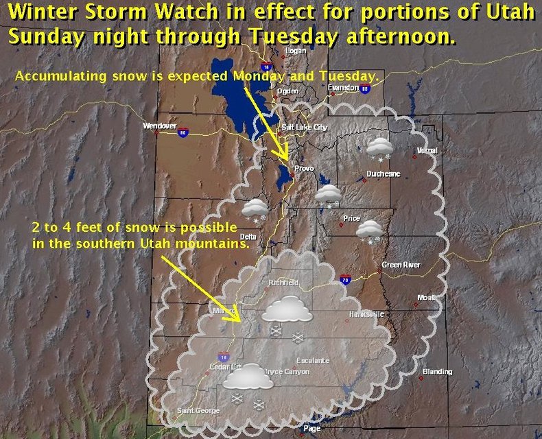
Here we go! Here we GO!
published
by ian_provo

Comments